
Pandemic walk: Scarborough Hydro Corridor


Think of greenery in Toronto’s east end and the Bluffs or the massive Rouge National Park probably come to mind. I have yet to tackle the latter – the sheer size of it would require a couple of days, and some major supplies. But something else to consider is this two-and-a-half kilometre, fully paved trail in the middle of Scarborough. It recently made NOW’s list of the Top 20 walks to take in Toronto.
Start: 3:40 pm, Wednesday, Ellesmere and Scarborough Golf Club
If you’re unfamiliar with Scarborough, this diagonal trek running east-west through the city’s major hydro corridor could be difficult to find. (I grew up nearby, and often used it as a shortcut.) The easternmost starting point (just south of Ellesmere) can be reached via any Ellesmere bus (those buses can be accessed from York Mills subway station). You can also take the Scarborough LRT system and get off at Ellesmere or Midland stations and transfer, but you’ll have to walk at least five minutes to get to Ellesmere – yes, even from Ellesmere Station, which I did (don’t ask – I hate the TTC).
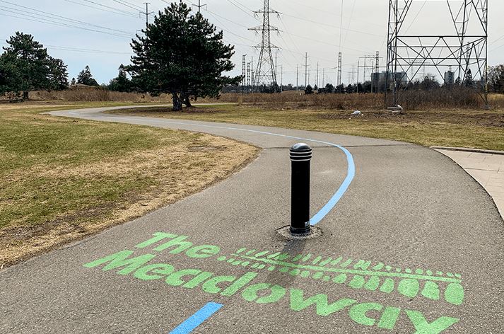
The Hydro Corridor gets its name from the underutilized “wasted” space beneath Scarborough’s hydro towers. It’s a key part in the massive project known as The Meadoway, which will eventually become a 16-kilometre trail connecting the Rouge with the East Don Trail system. The Don, of course, can also get you to downtown.
![]()